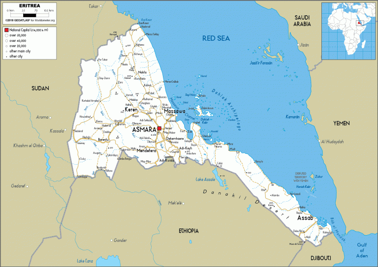
Eritrea - ኤርትራ
According to britannica.com the name Eritrea is the Italianized version of “Mera Erythraeum” a Latin name which means “Red Sea” due to its coastal location to the Red Sea.
The Red Sea was the route by which Christianity and Islam reached the area, and it was an important trade route that such powers as Turkey, Egypt, and Italy hoped to dominate by seizing control of ports on the Eritrean coast. Those ports promised access to the gold, coffee, and slaves sold by traders in the Ethiopian highlands to the south.
Geography
Eritrea is located on the Horn of Africa, its coastline, forming the northeastern edge of the country, extends for roughly 600 miles (1,000 km) from Cape Kasar, in the north, to the Strait of Mandeb, separating the Red Sea from the Gulf of Aden in the south. The country is bounded to the southeast by Djibouti, to the south by Ethiopia, and to the west by Sudan.
Population
Total Population
Ethnicity
History
Source: The World Factbook

